Business Survey 2024
Have your say in our business survey
PRESS RELEASE
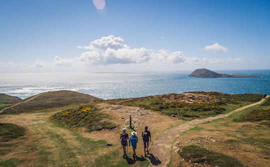
This National Walking Month (May), Wales Coast Path (WCP) is asking visitors and residents of Wales to help tackle coastal erosion — with a little help from their smartphones.
It’s all part of ‘CoastSnap’ — a global citizen science initiative — which has arrived in Wales for the first time this week, in partnership with the Wales Coastal Monitoring Centre (WCMC).
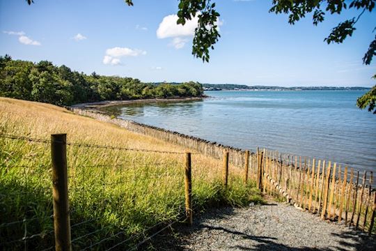
The initiative will encourage the public to take part in the programme by snapping smartphone photos at 19 designated photography points along the Wales Coast Path — from Whitmore Bay in Barry and Llandudno Promenade in north Wales to Tenby Harbour in Pembrokeshire.
The programme’s launch is the first piece of activity in the Wales Coast Path’s 2023 campaign, ‘Find Yours’ — which will encourage people to get out and find their slice of well-being, fun or adventure this season, all while looking after the 870 miles of coastline in Wales.
A bespoke QR code can be found on the phone cradles at each location, enabling walkers to submit their images quickly and easily to WCMC — in a bid to aid understanding of and help mitigate the impact of climate change on Wales’ coastline.
In 3 months, images submitted at each location will be collated to form a timelapse video — displaying the coastal changes over time. This data will then be used to inform the management of the Welsh coast for future generations.
Gwyn Nelson, Programme Manager at Wales Coastal Monitoring Centre, said: “The CoastSnap project will undoubtedly have a long-lasting impact across Wales, contributing towards global efforts to better understand — and offset — coastal erosion.
“Our coastlines can only be protected if we have detailed knowledge of the changes taking place — even if these changes are incremental. And often, the best way to understand the extent of coastal erosion is through close monitoring and regular image capture.
“We know so many people living in and visiting Wales are deeply passionate about protecting the environment — so we look forward to seeing the people of Wales and beyond engaging with the Wales Coast Path in this meaningful way.”
Clare Pillman, CEO of Natural Resources Wales, said: “So many of us love to take photos which capture special moments while out and about on the Path. By sharing them via CoastSnap — as well as the likes of Instagram or Facebook — walkers will be able to update their friends and contribute to essential coastal erosion research at the same time.
“Wales’ coastline is a precious landscape along which walkers of all ages and backgrounds can find reflection, escapism, discovery and adventure. We therefore hope that members of the Welsh public will take up this unique opportunity to support and protect our shared environment — for the benefit of current and future generations.
“And what better time to launch such a project than during Wales Outdoor Learning Week — seven days dedicated to showcasing how we can all benefit from learning in, learning about and learning for our natural environment?”
It comes following the success of Pembrokeshire Coast National Park Authority’s Changing Coasts project — launched in 2016 to record changes to the Pembrokeshire coastline, including dune and cliff erosion, flooding and changes in sand levels.
CoastSnap is an international movement, empowering the public to get involved in marine environment research. It was founded in 2017 by the University of New South Wales and New South Wales Department of Planning and Environment in Sydney, Australia, and is now live across 13 countries.
To find out more about CoastSnap in Wales and to find your nearest photography point along the Wales Coast Path, visit: Coastsnap | Wales Coastal Monitoring Centre (wcmc.wales)
Wales’ CoastSnap photography points can be found in the following locations:
-ENDS-
MEDIA ENQUIRIES
For more information and all media enquiries please contact Dafydd on walescoastpath@equinox.wales.
NOTES TO EDITORS
About Wales Coast Path: