

Redwick circular walk
Enjoy the vast views of the Severn Estuary on this flat easy walk
Start from the visitor centre on a network of paths and explore beyond the reserve
Paddy Dillon
The Wales Coast Path runs through the extensive Newport Wetlands National Nature Reserve. An industrial wasteland on the Gwent Levels was converted into a reserve, which was opened in 2000, compensating for habitat loss when the Cardiff Bay Barrage was constructed. A network of paths run from a visitor centre, but the reserve also extends far inland where field paths and farm tracks allow further explorations.
Distance: 7.8 miles or 12.5 kilometres
Start location: Newport Wetlands car park
Start Grid Ref: ST 33452 83498
Start What 3 Words: sunset.cheek.universally
Parking
Parking at Newport Wetlands.
Bus
None.
Train
None.
The circular route is marked in dark pink in the map image below. The purple flags show the start and finish point. The map includes a short-cut offering a shorter circular walk that is mentioned in the route description. View the route and download GPX link 'Newport Wetlands'.

1. The Newport Wetlands Visitor Centre has a car park but isn’t close to any bus services. If the visitor centre or its cafe is to be entered at the start, then walk past big rusty steel barriers to get there. If not intending to go to the visitor centre, turn right at the barriers as signposted for the Wales Coast Path. Follow a narrow path signposted for ‘Green Lanes and Coast Walk’ to leave the car park. Turn left along a concrete path past a grassy area then go along a woodland path. Turn left as marked to follow an obvious gritty path, passing beneath several overhead power lines leading the eye to Uskmouth Power Station. The Newport Wetlands were established on what were once sterile fuel ash lagoons beside the power station.
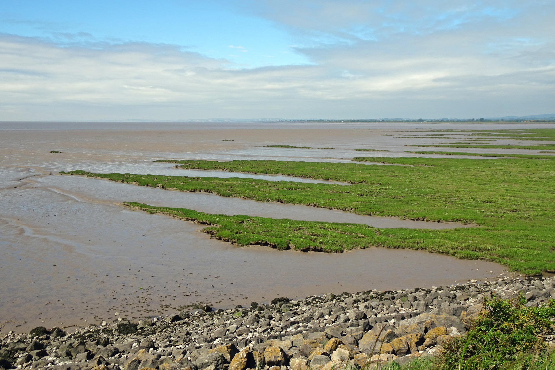
2. Eventually, turn left to walk beside the coast, where there is a bramble hedge beside a saltmarsh on the Severn Estuary, with reed-beds stretching inland. The broad path passes a little lighthouse, the East Usk Lighthouse, which was constructed in 1893. It originally stood on legs, but these were buried when the fuel ash lagoons were created, leaving only the upper half exposed. A noticeboard explains about birds that might be seen on the marshes and mudflats of the Severn Estuary. (If you only want a short walk and more time to spend birdwatching, feel free to take any of the paths leading inland, marked ‘VC’ for the visitor centre.) After some distance, the coastal path drops a little beyond a concrete sea wall and heads inland, still gritty underfoot and obvious to follow.
3. Join a road-end at Saltmarsh Farm and follow the bendy road called Saltmarsh Lane. The Wales Coast Path is signposted on the right, through a small gate set into a large gate, passing a Newport Wetlands notice. (Note that a short-cut is available, following Saltmarsh Lane to a nearby junction, turning left to pick up the route description again after Cross Farm. This saves about 2½ miles.) Keep to the left-hand side of a rugged field, go through a gate, cross a footbridge over a drain and turn left to walk beside a fence that was constructed to operate as a bird hide. Cross a footbridge bearing a gate and turn right. Keep to the right-hand side of a field, go through a large gate, then keep to the left-hand side of a long, narrow field. A marker post indicates a left turn, but note that there is access to the Redhouse Hide on the right, for birdwatchers. Cross a gated footbridge and keep to the left-hand side of another field. Cross another gated footbridge and turn left, following a path to a kissing gate leading onto a road.
4. Turn right and keep to the right-hand side of the road, soon turning right as signposted along a tarmac access road. Go through a gate and continue along a grassy track between rampant hedgerows and pass a Newport Wetlands notice. Later, go through a kissing gate beside a large gate and continue along the landward side of a grassy coastal embankment. Pass yet another Newport Wetlands notice and go through a kissing gate beside a large gate to reach a road junction in the village of Goldcliff. The Wales Coast Path turns right along the road, while the Farmers Arms lies to the left, but our route follows Chapel Road straight inland from the junction.
5. Walk along Chapel Road and turn left as signposted along a short path, going through a gate and across a footbridge into St Mary Magdalene’s churchyard. Keep right of the church to cross a gated footbridge into a field, then turn left and walk diagonally through the middle of the field. Cross a gated footbridge and pass a Newport Wetlands notice that explains about an area known as the Swaplands. Keep to the right-hand side of the Village Field, walking alongside a drain. Cross a gated footbridge and keep straight ahead along the right-hand side of another field. Cross another gated footbridge and walk straight ahead through yet another field. Cross a final gated footbridge and walk straight ahead along the left-hand side of a field to reach a step-stile beside a large gate.
6. Turn left to walk along a broad farm road, which might be muddy. Pass Henton Farm and Cross Farm to reach a road junction, then turn right to follow the road round a bend, before turning left through a large gate into a field. Walk diagonally to the right to cross the field then cross a gated footbridge. Keep to the right-hand side of a field and cross a step stile beside a large gate. Walk diagonally left through the next field and cross another gated footbridge. Aim well to the left of buildings in the village of Nash and cross yet another gated footbridge. Cross a road and immediately cross a gated footbridge, then aim towards a church spire to find a kissing gate leading out of a field and onto a road.
7. Follow the road between St Mary’s Church and the Waterloo Inn, and just before reaching the inn, turn right to walk through a small car park. Cross a footbridge that incorporates a stile to reach a field. Join the Wales Coast Path again at this point and turn left to follow it along the left-hand side of the field, behind the inn. Cross a gated footbridge and follow a drain called Skinner’s Reen beside a muddy field, crossing another gated footbridge. Walk straight through a big field, spotting a signpost to cross another gated footbridge. A short walk leads into the next field, then turn left to cross yet another gated footbridge. Keep to the left-hand side of a field, following its rampant hedgerow.
8. Cross a footbridge and turn right as marked. Cross another footbridge over a muddy patch in the field, then cross a gated footbridge. Keep to the right-hand side of a field, aiming for a prominent power station chimney. Cross two footbridges, followed by a gated footbridge, then turn left along a firm-surfaced track. Turn right through two kissing gates and follow a grassy track flanked by hedgerows. Another kissing gate leads onto the access road serving the Newport Wetlands Visitor Centre. The building is just to the left and if it is open it has a cafe and toilets, otherwise turn right to walk between the rusty steel barriers to return to the car park.