Porthcawl and Merthyr Mawr
Paddy Dillon
Bookmark this walk
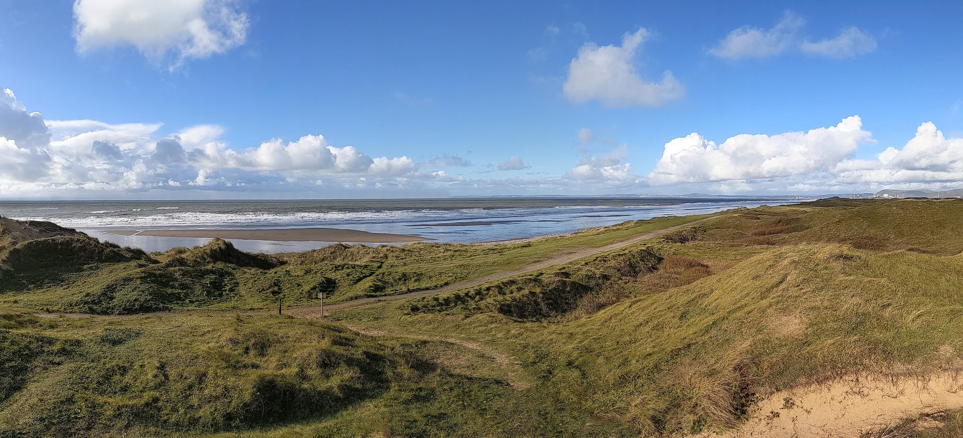
The Merthyr Mawr National Nature Reserve is a huge area of sand dunes that are mostly well vegetated and sometimes feature dense woodland. After exploring inland from Newton to Candleston Castle, the Wales Coast Path is joined and followed to the mouth of the Ogmore River and back towards Porthcawl.
Route detail
Distance: 6.5 miles or 10.5 kilometres
Start location: Newton Beach car park, near Porthcawl.
Start Grid Ref: SS 83696 76915
Start What 3 Words: tracks.tidy.bedspread
Transport to the start
Parking
Parking at Newton Beach near Porthcawl and Candleston Castle at Merthyr Mawr.
Bus
Daily bus services link Porthcawl and Bridgend. Use the Heol-y-Graig bus stops on Bridgend Road.
Train
None.
Map and GPX link
The circular route is marked in dark pink in the map image below. The purple flags show the start and finish point. Two GPX tracks are provided for this route. ‘Porthcawl and Merthyr Mawr 1’ starts from a
car park and ‘Porthcawl and Merthyr Mawr 2’ starts from a bus stop. The OS map shows
both starting points but the description is based on starting from the car park.

Detailed route description
1. Start at the Newton Beach car park on the outskirts of Porthcawl and follow Beach Road inland, using the pavement alongside. There are houses on both sides of the road then a spacious village green is reached at Newton. Have a look at St John’s Well, also known as Sandford’s Well, beside the road. St John’s Church, founded in the 12th century, stands beside a complex road junction with two pubs nearby. The Ancient Briton lies to the left, but turn right along Church Street to pass between the church and the Jolly Sailor.
2. If arriving by bus from the Heol-y-Graig bus stops on Bridgend Road, St John’s Church is signposted along Clevis Crescent and over Clevis Hill. On reaching the complex road junction from this direction, turn left along Church Street to pass between the church and the Jolly Sailor.
3. The road bends right and runs downhill a little, becoming Bryneglwys Avenue. Turn left at this point along a tarmac path signposted as a public footpath and go through a kissing gate. Modern houses stand on either side of the path. Cross a road to continue along another tarmac path as signposted. Cross yet another road to continue along a narrow, trodden path as signposted, now leaving the suburbs of Newton to enter an area of grass, bracken, bushes and trees. Bear in mind that a maze-like network of paths lies ahead, so take care to follow the route description carefully, watching for marker posts at a series of path junctions.
4. Walk straight ahead along the most obvious path, which has occasional marker posts. Sometimes the trees and bushes grow densely alongside the path and at other times there is more space. The path runs near the edge of the woodland, sometimes following a stone wall, passing an entrance to Gorwellian House, which is a Girlguiding property. The path suddenly turns right and runs down through an eroded sandy gully. Continue down a broad, sandy woodland path to reach an open space where other paths cross.
5. Turn left here, where a marker post lacks directional arrows. Soon afterwards, keep left again at another marker post. The path continues deep into woodland then gradually rises and passes through a kissing gate. A sandy path rises through a clearing, reaching an intersection with other paths at another marker post at Cwm y Gaer. Keep right and follow a woodland path that generally climbs, but has a couple of slight descents. Go through a kissing gate and continue uphill, squeezing past sea buckthorn bushes. Go over a crest, through a kissing gate and continue through woodland. The path generally descends, with slight ascents, while following a wire fence.
6. The fence suddenly turns left, then a marker arrow on a fencepost indicates a right turn. Walk until a kissing gate is reached, and once through it, the path splits. Keep to the right to stay in the woods, following a sunken path downhill. Turn right at an unmarked path junction, later going through a kissing gate beside a large gate. Reach a marker post where sandy paths intersect. Walk straight ahead and uphill, staying on the most obvious undulating path. However, watch carefully to spot a marker post on the left, bearing an arrow pointing left, and be sure to turn left at that point.
7. A narrow path runs almost level between vegetated dunes. Go through a kissing gate beside a large gate and the path remains narrow, but it is also obvious to follow. It leads down through oak and birch woodland on a steepening slope. The path itself turns to soft sand, later levelling out beside a stream. In dry weather there might be no stream, while in wet weather it could be difficult to cross. Look nearby to spot a rudimentary plank footbridge to get to the other side. Turn right to follow a clear track, which quickly leads to a car park. Be sure to look to the left to spot the ivy-clad ruins of Candleston Castle, a 14th century fortified manor house.
8. Walk through the car park towards a little toilet block to find a Wales Coast Path marker post to the right. Follow a sandy track gently downstream through woodland. The track rises from the wood and a marker post indicates a right turn along a sandy path. However, this only cuts out a short section of the track, which is followed onwards. Later, the track gives way to a sandy groove that follows a river downstream.
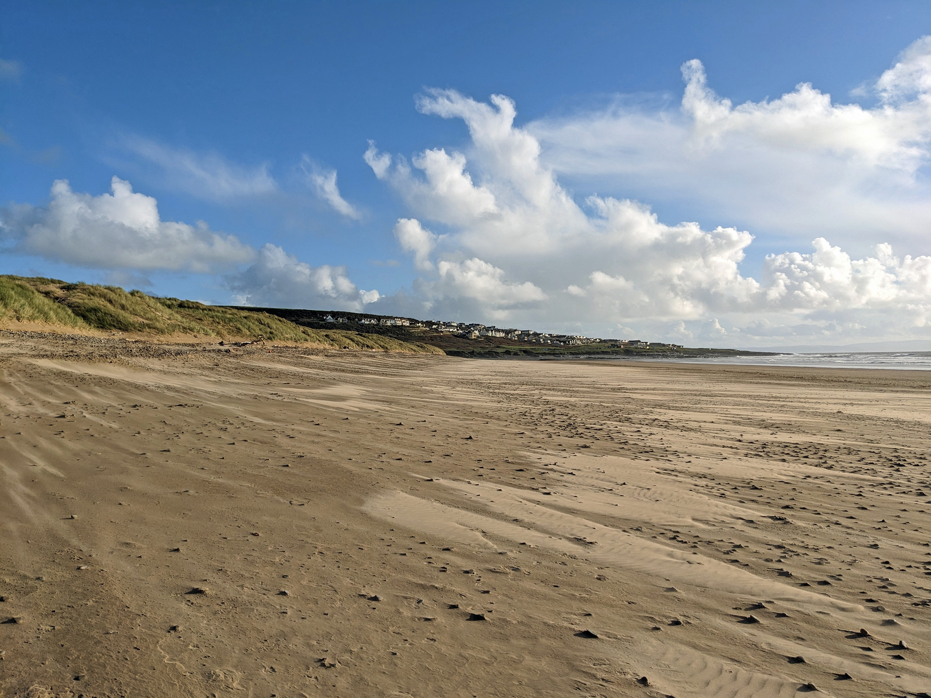
9. Cross a footbridge and walk along a sandy beach between saltmarsh and sand dunes, following the tidal Ogmore River. Bear in mind that when the tide is very high, this area can flood completely, in which case be prepared to wait an hour or so for the ebb. Note how high driftwood has accumulated along the shore. There is a pebble beach where the Ogmore River reaches the open sea, but there is no need for an uncomfortable walk. Instead, step ashore as marked to follow a path over low sand dunes.
10. Follow any path onwards, but eventually there is too much soft sand and it is easier to walk along the beach, where the damp sand is easier underfoot, provided that the tide is out. Enjoy the beach walk, but watch carefully to spot a marker post that reveals a good path behind the dunes, which is easier underfoot than the bare rock and pebbles further along the beach. The path eventually passes lifeguard cabins, returning to the Newton Beach car park.
11. If you arrived by bus, finish the walk by turning right to follow Beach Road inland, walking straight through the spacious green at Newton, over Clevis Hill, to return to the Heol-y-Graig bus stops on Bridgend Road.