

Chepstow to Sedbury and back
The meeting point of the southern terminous of the path with Offa's Dyke National Trail
An opportunity to pass under the Prince of Wales bridge and enjoy the views of Caldicot castle on your way back
Paddy Dillon
This walk leaves Caldicot and links with the Wales Coast Path, running close to the busy M4 motorway to reach the Prince of Wales Bridge, Sudbrook and Black Rock. Heading inland, the walk visits Portskewett and runs through the open spaces of Harold’s Park and the Cornfield Project. Towards the end of the walk Caldicot Castle and Country Park form a splendid open space close to the town centre.
Distance: 7.2 miles or 11.6 kilometres
Start location: Caldicot Cross, Caldicot
Start Grid Ref: ST 48087 88370
Start What 3 Words: gazes.tower.paces
Parking
Parking at the Jubilee Way Car Park and Caldicot Country Park.
Bus
Daily bus services link Caldicot with Newport and Chepstow.
Train
Daily train services to Caldicot from Cardiff, Gloucester and Cheltenham Spa.
The circular route is marked in dark pink in the map image below. The purple flags show the start and finish point. The map shows a short variant route at Black Rock, where the tide very occasionally prevents the Wales Coast Path from being followed, requiring a short detour inland. View the route and download GPX link 'Caldicot and Sudbrook'.

1. Start at the Cross Inn at Caldicot Cross in the centre of Caldicot. A cross made of thousands of thin slates stands in a paved pedestrianised area. From the Cross Inn and nearby bus stops, follow Sandy Lane to a nearby mini roundabout and turn left onto Jubilee Way. If arriving by car use the Jubilee Way Car Park. Opposite the car park, a tarmac path runs through a green space parallel to Jubilee Way, passing the King George V Playing Fields. Emerge into another open space and keep straight ahead along the tarmac path to reach a small car park. Turn right and left as indicated by cycleway signs. The path squeezes between garden fences, hedges and walls at the backs of houses, passing the Second Caldicot Scout Group hut.
2. At the end of the path, turn left along a road and almost immediately turn right to use a pedestrian crossing. Walk gently downhill along Station Road. Turn left at a road junction where there is a small green space and follow signs for cycleway number 4. The road leads to Caldicot Railway Station, where it runs beneath a bridge with low headroom. (If arriving by train and starting from the eastbound line towards England, leave the platform and turn right to walk beneath the bridge. If starting on the westbound line towards Newport, leave the platform and turn right to walk away from the bridge.)
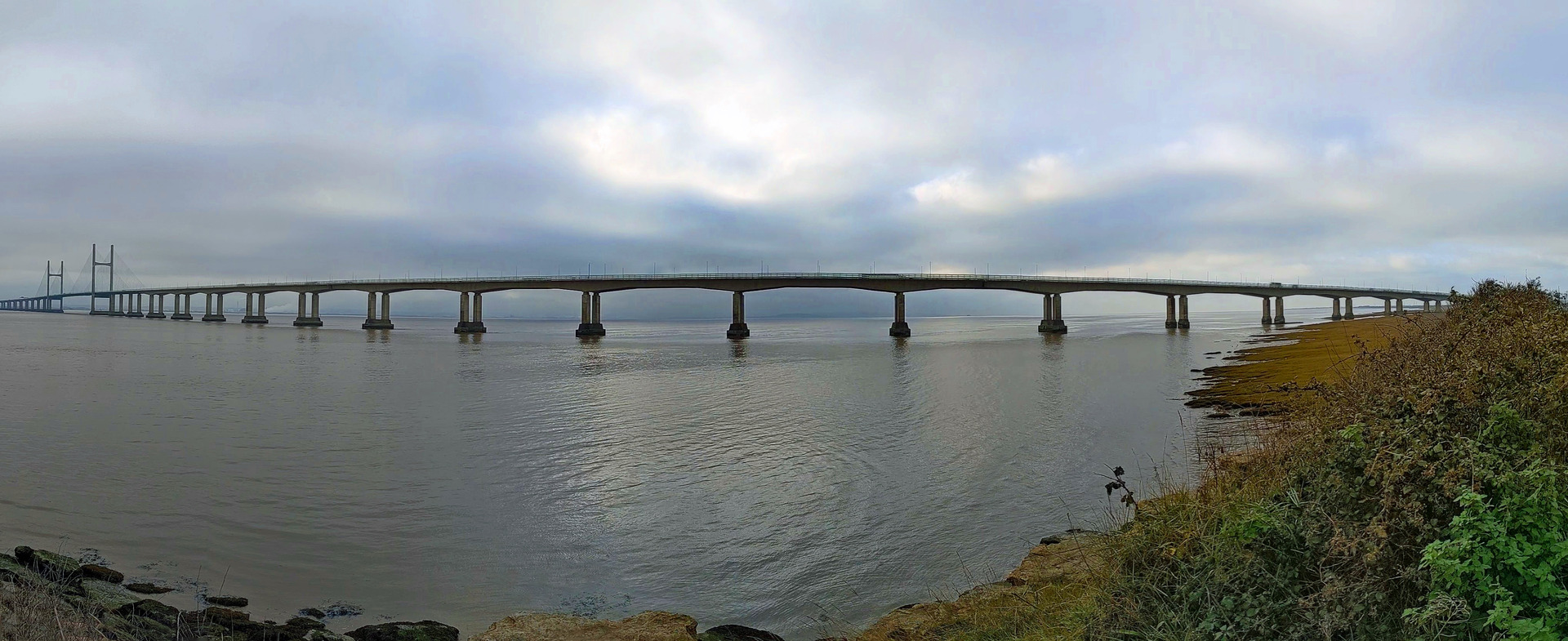
3. After the railway bridge, turn left almost immediately as signposted for the Wales Coast Path, following a minor road running parallel to the railway. The road is little used and is potholed at first, gaining a better surface further along. The road rises, then keep walking straight ahead as marked at a junction. Later, turn right as signposted through a kissing gate and follow a path straight between the legs of a tall pylon. Pass brambles and grassy areas then go through another kissing gate. A footbridge arches over the busy M4 motorway, offering good views of the Severn Estuary and the Prince of Wales Bridge leading to England.
4. Go through two kissing gates and turn left as signposted for the Wales Coast Path. Follow the path along a grassy sea wall with marsh to the right and fields to the left, as well as the constant roar of the motorway. Go through two more kissing gates, then two narrow concrete roads run parallel to the motorway, so use the one closest to the motorway to continue, which is slightly more elevated than the other road. Follow the concrete road under the first concrete span of the Prince of Wales Bridge and continue as signposted past a gate. The concrete gives way to a path with a grassy embankment to the right and a drainage ditch and woodland to the left. The path later runs along the top of the embankment, and later still it climbs a little to pass a housing estate.
5. Go through a kissing gate and the path splits, so turn right as signposted, passing masses of brambles. The path overlooks rocky outcrops and enters Sudbrook Camp, the site of an Iron Age fort surrounded by earth embankments, now occupied by a football pitch. Pass the ruined Holy Trinity Church and follow a path into the village of Sudbrook. The unassuming Tunnel Centre on Camp Road has information panels on its wall, but if the door is open, go inside to learn more about the history and construction of the railway tunnel beneath the Severn Estuary.
6. Turn right to cross an old level crossing and turn right again to follow another road between Sudbrook Pumping Station and a former school. At the end of the road a Wales Coast Path points straight ahead along a dirt road. This becomes a fine path as it leaves the village, following the coast, although views are obscured by hedgerows. Reach a noticeboard at a path junction and turn right, passing a notice for the Black Rock Picnic Site. Enter a clearing surrounded by trees, where there is a sculpture of ‘The Fisherman’ and a notice explaining about local fishing methods, using lave nets. Soon afterwards there is a choice of routes, depending on the state of the tide.
7. If the tide is out, walk down past an iron man sculpture, ‘The Engineer’, to follow a rock-buttressed path to a kissing gate. Continue walking past a beach and saltmarsh at the base of a red sandstone cliff. Keep walking until a sea wall is reached, where there is a marker post. Turn sharp left along a path behind the sea wall. Go through a kissing gate then turn right to walk inland along the right-hand side of a field.
8. If the tide is high and the coast path can’t be followed, head straight inland along a road, then turn right at Black Rock Barn to follow a track. Go through a kissing gate beside a large gate, then turn left and walk gently downhill, heading further inland along the left-hand side of a field.
9. Both the low-water and high-water paths meet and pass through a gap in a hedge to enter a narrow field. Walk straight through this field and note an old railway arch to the left while approaching a kissing gate leading onto a road. Turn right along and follow Black Rock Road as it rises past houses and crosses a railway line. Reach a road junction where there is a bus shelter. Turn right downhill along the road then turn left at a junction as signposted for Leechpool. Walk up the road and pass a house then look for a gap in the hedgerow on the left. A public footpath signpost and a kissing gate show the way into a field.
10. Walk straight across the field and look ahead to spot a kissing gate. The gentle hill to the left bears the scant remains of the Neolithic Heston Brake Long Barrow. Go through the kissing gate into the next field and keep to the right-hand side of it. Walk gently uphill and downhill and go through another kissing gate. Walk downhill along the right-hand side of another field, go through another kissing gate and walk straight ahead, up through yet another field. Go through a kissing gate and keep to the left-hand side of a field, following a fence to a house, then go through another kissing gate. Follow a track down through woodland, reaching a road where the Portskewett Inn lies just to the left. However, turn right instead to continue.
11. Follow the road to a junction and turn left. St Mary’s Church lies to the right and a building in the churchyard serves as the Portskewett Heritage Centre. Walk to a nearby road junction with traffic lights and turn right through a kissing gate. A path leads into Harold’s Park, which is an informal park with hummocky grassland. Walk alongside the churchyard wall to reach a corner, then turn left and walk gently downhill, passing a line of trees before walking through a grassy area to pass through a gate. Reach a small car park beside the Portskewett and Sudbrook Recreation Hall.
12. Keep to the right of a play park to pick up and follow a path into the Cornfield Project, where an open space has been developed as a park for the whole community to enjoy. Follow a broad and clear gritty path all the way through, keeping to the right-hand side. A narrow path finally leaves the area, becoming squeezed between tall fences on the way through an industrial estate. Continue along a road through the rest of the estate, reaching what was once a crossroads. Walk straight ahead, along a road now blocked to traffic, following Pill Row past old terraced houses, followed by modern houses.
13. Reach a junction with a busy road beside a big stone house. Cross the road from one bus shelter to another and turn right to follow the pavement alongside the road. Reach a roundabout and turn left for Caldicot Castle and Country Park. Go through a kissing gate and use a path to the left of the access road. Cross a footbridge, then the castle lies to the right and can be visited if it is open. The castle dates from around 1100. Sometimes it was in the hands of one family for generations, but it was eventually reduced to a ruin. It was restored in the 19th century and was opened to the public in 1965. It serves as a wedding venue but tours are occasionally available. The surrounding Country Park can be explored at any time.
14. Follow the path running parallel to the road to continue, reaching the traffic-calmed Church Road. St Mary’s Church lies across the road through a lych gate, while the Castle Inn lies to the left. Turning left to follow the road leads straight back to Caldicot Cross.