

Caldicot and Sudbrook
An opportunity to pass under the Prince of Wales bridge and enjoy the views of Caldicot castle on your way back
The meeting point of the southern terminous of the path with Offa's Dyke National Trail
Paddy Dillon
The southern terminus of the Wales Coast Path is beside the tidal River Wye at Chepstow, where all sorts of celebratory stonework is displayed. For the sake of a short walk, it is possible to cross a bridge, join the Offa’s Dyke Path National Trail, and follow it to its southern terminus on Sedbury Cliff, overlooking the mouth of the River Severn. Retrace steps afterwards to Chepstow.
Distance: 5.3 miles or 8.5 kilometres
Start location: Chepstow Railway Station
Start Grid Ref: ST 53641 93689
Start What 3 Words: corkscrew.flopped.enrolling
Parking
Parking at Chepstow Railway Station, Nelson Street, Welsh Street, Castle Dell and other locations around town.
Bus
Daily bus services link Chepstow with Newport and Bristol. Local buses serve Sedbury, except Sundays.
Train
Daily CrossCountry and Transport for Wales trains serve Chepstow from Cardiff, Cheltenham Spa and Birmingham.
The circular route is marked in dark pink in the map image below. The purple flags show the start and finish point. View the route and download GPX link 'Chepstow to Sedbury and back'

1. Start at Chepstow railway station and follow the road away from it. Walk straight through a crossroads to reach traffic lights and turn left to go through a subway beneath a busy main road. Climb steps and turn right to walk towards Chepstow Parish Church, or the Priory Church of St Mary. This was founded by the Benedictine order in 1072. Keep to the left of the church to walk down a concrete path between iron railings, signposted as the Wales Coast Path. Continue straight down Lower Church Street to reach the Boat Inn, turning left to follow the bank of the River Wye, noting several features that mark the end of the Wales Coast Path, with the path logo, the ‘Dragonshell’ repeated many times. The Wales Coast Path starts on the outskirts of Chester and covers 870 miles (1400km).
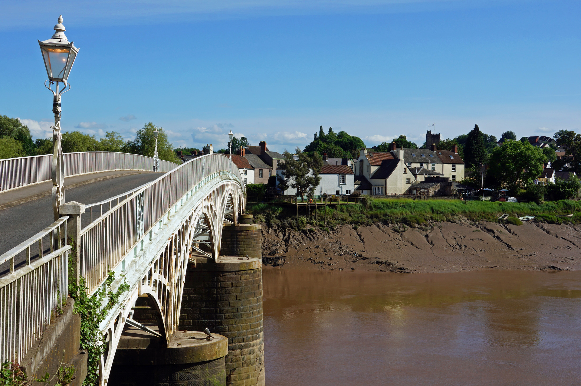
2. Cross the ornate cast-iron Old Wye Bridge, dated 1816, also known as Chepstow Bridge or Town Bridge. Chepstow is in Wales (Monmouthshire), while Tutshill on the other side of the bridge is in England (Gloucestershire). Walk straight up a steep and narrow traffic-free lane, signposted as ‘leading to Offa’s Dyke Path’. Turn right at the first opportunity to follow another narrow traffic-free lane, where the Offa’s Dyke Path is marked by distinctive acorn logos. Follow it past houses hidden behind tall stone walls. As soon as the road levels out, turn right down a steep, narrow, enclosed path. This winds around and passes the gardens of houses before climbing back to a road.
3. Turn right along the road, then right again down another road into Sedbury. Turn right along Wyebank Avenue, left at a road junction, then right as signposted for Offa’s Dyke Path down a narrow, enclosed path. Emerge onto a grassy slope just below Wyebank Road and walk parallel to the road until another path descends to the right. When it joins an access road, keep left to follow it. Rise gently and pass houses at Offa’s Close and continue straight ahead along Mercian Way. (The road follows the line of Offa’s Dyke, but no trace of the old earthwork remains.) The road runs downhill and suddenly turns right, so turn left instead along another narrow, enclosed path.
4. Turn right down a road, then cross a footbridge and go through a kissing gate. Cross an earthwork and follow a path straight up through a field, going through another kissing gate at the top. Cross a road to continue as signposted a short way up a farm access road. Turn right as signposted through a kissing gate and walk straight ahead alongside a field. Go through another kissing gate and walk straight ahead along the grassy crest of Offa’s Dyke as the embankment drops into a valley. Cross a gated footbridge and climb a few steps. A short, steep climb leads to a boulder bearing a commemorative plaque for the Offa’s Dyke Path, on top of Sedbury Cliffs.
5. There is a view across the mouth of the River Severn, which is spanned by the Severn Road Bridge. Imagine turning round and following the Offa’s Dyke Path northwards for 177 miles (285km) to Prestatyn on the north coast of Wales. The immediate surroundings are well wooded, but walk a short way straight downhill to appreciate what a steep slope the dyke was built on top of. If you do this, then turn right at the bottom to return to the gated footbridge.
6. All that remains is to retrace steps through Sedbury and Tutshill to return to Chepstow, following the signposts and acorn logos for the Offa’s Dyke Path. Alternatively, when the first road is reached, turn left to reach a nearby bus shelter. This is served daily by a handful of C4 Newport Bus services, except Sundays.