Trefin chapel circular walks, Pembrokeshire
A choice of three circular walks with equally...
An invigorating walk through coast and countryside that takes in an array of significant religious sites – plus some of Pembrokeshire’s most spectacular clifftops
St Dogmaels Abbey, St Dogmaels
Walk route 1: 11 miles or 17 kms
Walk route 2: 8.5 miles or 14 kms
The numbers refer to a point along your walk. View the points on the route map
1. St Dogmaels car park: Before beginning your walk from the car park in St Dogmaels, take some time to explore the village, abbey with adjacent visitor centre café and Y Felin Water Mill Cross the road towards the post office following the Wales Coast Path (WCP) sign onto Church Street. You’ll soon reach the entrance gates to St Thomas the Apostle church.
2. St Dogmaels Abbey: A path to the left in the churchyard leads through an arched doorway to St Dogmaels Abbey. Located by the River Teifi, the Abbey depended on income from gardens, orchards, anchorage rights, mills, rent and fishing (especially for herring). The centre of the village is a sheltered bowl of pasture land that was once orchards. Seine fishing practiced by the monks was still used in recent times.
Across the road from the Abbey is Y Felin, a working watermill with mediaeval foundations. Carved into the 16th century doors are overlapping V's – ritual ‘Marian markings’ believed to be invocations to the Virgin Mary for protection. Watching the mill working is fascinating. Water dashes over the waterwheel, timbers strain, stones grind and freshly milled flour tumbles into sacks. Tours available.
3. Village Green: Return to the High Street car park and head uphill, turning right at the WCP sign along Feidr Fach to the Teifi Netpool Inn Bed and Breakfast, where historically, fisherman drew lots to decide which pools they would fish for salmon and sea trout (sewin). The village green was once filled with over 200 wooden posts (standards) used by fishermen to dry and repair nets, though now only a dozen remain.
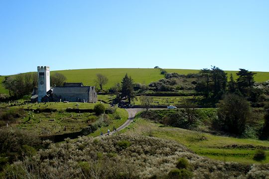
4. Official start of Pembrokeshire path: Follow Wales Coast Path signs north along a concrete path leading to B4546 road, look left to see Capel Degwel Independent Chapel before heading downhill towards the Moorings and the marker for the official start of the Pembrokeshire Coast Path National Trail section of the Wales Coast Path.
5. Café and car park: Follow the B4546 road for 1.4 miles or 2.2 km to Poppit Café. There are no verges for much of this section, so take extra care. (At low tide, it’s possible to follow a footpath over stepping stones to the beach starting from the WW2 memorial bench).
Behind Poppit Café follow the road north uphill. There are great views of Cardigan Island nature reserve. At Allt y Coed the road becomes a stony track, follow it downhill sharply right, pass through Allt y Goed farmyard following the WCP signs past the buildings onto the Cemaes headland.
6. From Cemaes Head Nature Reserve, looking north-east on a good day it’s possible to see Plynlimon, Snowdonia, the Llŷn Peninsula and Bardsey Island (44 miles or 71km away). Rounding Cemaes Head, the cliffs rise to over 574 feet or 175 metres, the highest in Pembrokeshire. Stone from some locations here was quarried for constructing St Dogmaels Abbey and transported by boat.
7. At the World War II Coastguard Lookout Post, the view south is Strumble Head and lighthouse stretching out towards Ireland. Follow the first footpath sign inland over 3 stiles, then follow the left bridleway downhill between dry-stone walls. Look out for a wall stile to the right where steps projecting from the drystone wall lead up to the footpath and wooden stile on top of the wall.
Follow this footpath through trees, along a farm track for 400 yards or 340m to a bridleway to the right leading to the ruins of Bryn Salem Independent Chapel. Turn left. At Cippyn Fawr Farm turn right along the bridleway to the recently closed Gerizim Baptist Chapel.
8. From Gerizim Chapel follow the road left, downhill. At the sharp bend take the footpath right along a track, down across fields, a wooden footbridge and on towards Manian Fawr Farm.
9. For a shorter walk, carry on through the farm and follow the Wales Coast Path back to St Dogmaels marking the end of walk route 2 (a shorter circular route).
10. Alternatively for a longer walk, at Manian Fawr Farm take the bridleway uphill enjoying backward sea views before entering woodland.
11. Follow the bridleway until you reach a crossroads. Turn left at the farm track crossroads to the country road. Turn left and follow the road towards Bryncws Farm. Here, turn right onto Bryncws farm track, turn left at the pond through gates into a lane bounded by hedges. Follow footpath arrows over fields, into woodland and on to the road.
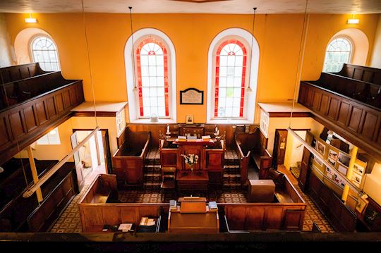
12. For a shortcut back to the village (see dashed red line on map), turn left downhill to St Dogmaels past the stunning Art Deco-style Bethsaida Baptist Chapel, now sympathetically converted to a bed and breakfast. The shortcut is approximately half a mile or nearly 1 km.
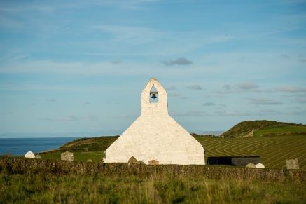
13. If you have time to visit Blaunwaun Baptist Chapel and Baptism pool, turn right. Take the next footpath left and pass downhill near Foxhill Farm to Cwmdegwel Road. Go left and take next right for Blaenwaun Chapel Baptism Pool, Y Bedyddfa, with its amphitheatre of terraced seating for congregations to witness full-immersion baptism. A little further uphill is Blaenwaun Baptist Chapel Blaenwaun graveyard bears poignant reminders of lives lived and lost at sea, with many gravestones bearing carvings of anchors, knots and ship names.
14. Walk down the quiet Cwmdegwel Road enjoying the sound of the stream which is all the remains of the massive glacial outflow that gouged out this deep ravine. Follow WCP signs, past the Abbey Visitor Centre Café back to your starting point in St Dogmaels.
Named after a 5th century saint, St Dogmaels Abbey was built some 170 metres from the site of the ‘clas’ he founded (an important early welsh Christian monastery and centre of teaching).
Founded as a Priory by Robert fitz Martin in 1113, it was formally designated as an Abbey in 1121 although very little fabric survives from this time.
Look out for the distinctive 13th century stonework with alternating bands of local slate and sandstone rubble – a technique designed to create strong bonds that was inspired by the walls of Constantinople.
Despite being closed and demolished in 1537 during Henry VIII’s Dissolution of the Monasteries, it still provides many fascinating insights into the lives of the Tironensian monks who lived, worshipped and worked here.
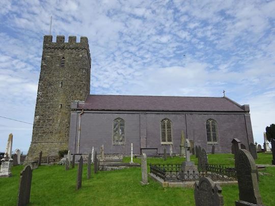
Right next to the Abbey, you’ll find St Thomas’ church. Built in 1847 it’s also home to the intriguing Sagranus Stone. Standing 7 feet or 2.1 metres high, this 5th century pillar stone is inscribed in both Latin and Ogam (the early Gaelic lettering system of Ireland) and is thought to have originated from the church of St Dogmael’s first monastery.
Find out more about St Dogmaels Abbey
St Dogmaels is a large village with small shops, pubs and accommodation with local bus services to Poppit and nearby Cardigan.
At Poppit Sands - Bus stop (Poppit Rocket – thrice daily return – Cardigan to Fishguard). Large National Park car park (charge in season), cafe, radar WC, WC. Wheelchair access to large sandy beach with a blue flag award.
Find out more about the coastal buses serving the Pembrokeshire coastline
You can also download the printable the walking itinerary and the route map to take with you on your walk.
Download St Dogmaels Abbey circular walks walking itinerary (PDF, 1.95 MB)
Download St Dogmaels Abbey circular walks route map (JPEG, 2.19 MB)
Acknowledgments