

Point of Ayr
A great circular walk from Talacre, on a splendid...
A great circular walk from Talacre, on a splendid sandy beach with the option of a shorter walk behind the sand dunes
Paddy Dillon
The Wales Coast Path follows a splendid sandy beach from Talacre, passing a little lighthouse. A wooden walkway offers a route inland, linking with a cycleway running back to Talacre. In case of a particularly high tide, or stinging windblown sand, a shorter alternative route is also available behind the sand dunes, visiting a small pool inhabited by natterjack toads.
Distance: Long route 3.1 miles or 5 kilometres, Short route 1.6 miles or 2.6 kilometres
Start location: Talacre Beach road-end
Start Grid Ref: SJ 12457 84841
Start What 3 Words: showrooms.hamster.butterfly
The circular route is marked in dark pink in the map image below. The purple flags show the start and finish point. The Ordnance Survey 1:25,000 map is marked with two circular routes. A longer one uses more of the Wales Coast Path but it can’t be followed during the highest tides. A shorter route uses very little of the Wales Coast Path but can be used any time. View the route and download GPX link Talacre Warren

1. If arriving by bus, the bus stop is at the Talacre Beach Club, and it is necessary to walk from there to the end of Station Road, which will add another 1km / ½ mile to the distance. If arriving by car, either use a car park on the right before reaching the end of the road, or continue over and embankment and park beside the saltmarsh, if the barrier gate is open. Whatever approach is taken, the walk starts at the end of the road, on top of the embankment, where the Wales Coast Path is signposted.
2. Follow the signpost ‘to the beach’, walking along the top of the embankment above the saltmarsh. The path soon gives way to a wooden walkway, where there is a map-board and a notice offering information about what the dunes were like during World War II, when people fleeing bombed cities built shacks in the area. Reach the end of the walkway and continue straight ahead through a gap in the sand dunes to reach a broad, sandy beach beyond. (In case of a particularly high tide, turn left at the end of the wooden walkway and follow the shorter alternative route described below.)
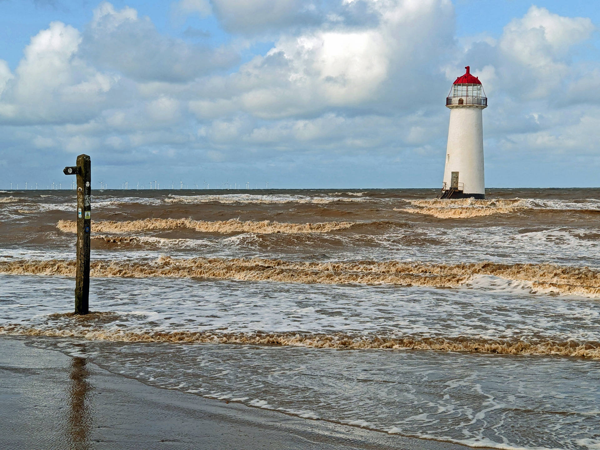
3. When the tide is out, there is plenty of space to walk along the beach, and there is also an opportunity to approach a small, disused lighthouse which leans slightly to one side. Signposts have been planted along the beach, and at high tide the water comes past them, pushing walkers closer and closer to the dunes. Once committed to following the beach, keep walking and don’t head inland until a very obvious wooden walkway appears. Clambering over the soft sand dunes and trampling the vegetation is discouraged.
4. The wooden walkway offers a firm path through the dunes, reaching a nature reserve noticeboard offering information about the Gronant Dunes and Talacre Warren. A broken shell path links with a road, which in turn passes mobile homes in the Presthaven Beach Resort. Turn left at a road junction and follow the road through the resort. Walk along whatever side of the road has a pavement, finally reaching a turning circle where there is another nature reserve noticeboard.
5. A broad, fenced cycleway is signposted ahead for Talacre, and Carneddau ponies are grazed here to help control the vegetation. Halfway along the cycleway a concrete track on the left is signposted ‘to the beach’. Keep straight ahead here, but note that this is where the shorter alternative walk joins. When a triangular path junction is reached, right is signposted for Talacre, which offers the quickest way back to the bus stop, otherwise keep left as signposted for Talacre and Ffynnongroyw. A broad wooden walkway gives way to another stretch of tarmac path in a wooded area, leading back to the road-end where the walk started.
In case of a particularly high tide or to avoid stinging sand on a windy day, turn left at the end of the wooden walkway, and follow a path that stays behind the sand dunes. The path is marked with wooden posts and is sometimes sandy underfoot and sometimes grassy. Eventually, the path links with a concrete track. Follow this onwards and pass a pool noted for its population of natterjack toads. When a triangular junction is reached, turn left to follow a short concrete track to join a tarmac cycleway. Turn left as signposted for Talacre and follow the main route description above. The overall distance is half that of the main circular walk.
